Descrizione
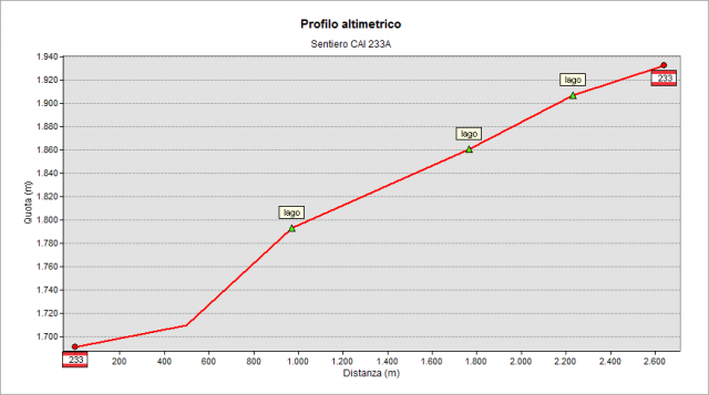
The track comes off the path n° 233 when it reaches the basin of Cardeto; it runs along all the lakes of the basin. It comes off - on the left - at an altitude of 1680 m about and climbs through the pastures, reaching the lower lake (1708 m), the middle lake (1798 m) and the upper lake (1862 m). Finally, after a little pond, it reaches the “Baita di Monte Cardeto” Refuge (1921 m) and the path n° 233 again, which allows you to return to the starting point (Gromo, right), or to climb the Portula Pass (left).
Topografia
Profilo altimetrico
Sentieri collegati
Documentazione
Cartografia
Carta Escursionistica della Provincia di Bergamo
Tavola 02