Descrizione
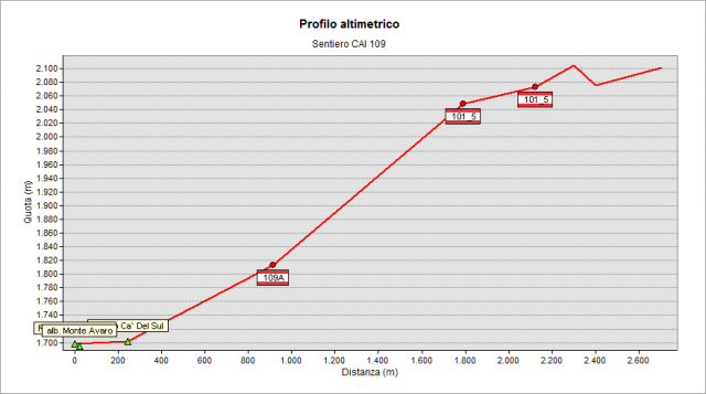
The track starts from “dell'Avaro” Plains, close to the hotel (1702 m). Walk along a stretch of dirt road that goes up the slope northward. After about 10-15’ you find a crossroad: on your left the path n° 109A begins, going to reach the junction with path n° 101 (direction: Benigni Hut); on your right, instead, the path n° 109 continues. You go up firmly to the right until to cross the path n° 101. Then continue to the right (east), along the path n° 101, until you reach the junction to the lakes. Leave the path n° 101 (that begins to descend) and turn left - gaining some meters in altitude – and follow the path along the hillside until to reach the basin of Ponteranica Lakes (2115 m).
Topografia
Sentieri collegati
Documentazione
Note
it is useful to point out that car’s transit over “della Maddalena” Col place (is along the way thad leads to "dell'Avaro" Plains, also used to arrive at the beginning of the paths n° 109 and n°108) is for a fee, now: the daily allowance costs 2 €. You can find the ticket distribution machine at the beginning of the toll section. (Updated: June 26, 2016).