Descrizione
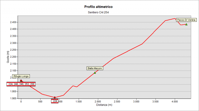
Starting from the Longo Hut (2026 m), go down the dirt road/path n° 224 - leading to the “del Prato” lake - for less than 1 km, about 10', until you see a signposted junction on your right (about 1920 m a.s.l.): that is the starting point of path n° 254. The track rises firmly and by bends, reaching the meadows of Masoni hut (2013 m). It continues to climb the slope through a more rocky environment, to gain the watershed of the Valtellina at 2509 m (nice north view on the underlying Venina valley and its homonymous lake). The track continues, still easterly, remaining just above the ridge. Slight downhill - after a funny section between rocks - finally it comes to Venina Pass (2442 m). From Venina Pass, you can get off northwards by a track, enter Venina valley and reach the “di Venina” Lake (1841 m).
Topografia
Sentieri collegati
Documentazione
Note
Beyond Venina Pass - descending by track for approx. 30 ' – you can reach the old smelting furnace placed at the head of Venina valley. This furnace, the largest in Orobie, is in good condition and doubtless it is worth a visit. Here, the iron ore was subjected to a first purification treatment, in order to carry less weight downstream, then. The iron ore was extracted in the nearby iron vein, which gave rise to the name of the valley (“Venina” originates from the italian word “vena”, with the meaning of mineral vein).