Descrizione
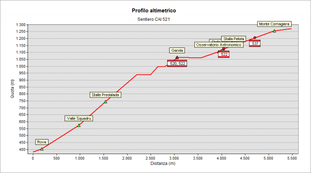
The path starts along the road running right the little church located in Saint Mauro’s square in Gazzaniga village. It goes through the higher part of the suburb and through the overhead fields. As it reaches the wood, it weaves up toward Squadrù valley. Then it turns first left going up as far as Cuca’s place and then right as far as Pradelada’s mountain lodge. From here the track goes steeply up on Monte Ganda’s slope, then it turns left and it gradually goes up as far as Ganda’s village, in whose square path 522, path 520 and path 538 merge. The church dates back to XVII century and keeps G.B. Paganessi’s frescos (a painter born in Vertova). Following the signs, you get to Murena’s place (where path 522 and 521 come together for a short stretch). From here the path goes up toward Monte Poieto passing by the Orobic Pre-alps’ astronomical observatory. You get then to a fork where path 521 diverges links from path 522 and in a short time you get in sight of Cornagera’s rock towers, that is a climbing training ground opened about 100 years ago. Then you turn right and you get to an impressive big valley called the Labyrinth. You walk along it, you turn left and, climbing up on small rocks, you quickly get to Cornagera’s top (1311 meters high).
translated from the class 2D del corso "Tecnico dei servizi di animazione turistico-sportiva e del tempo libero" di Clusone
Topografia