Descrizione
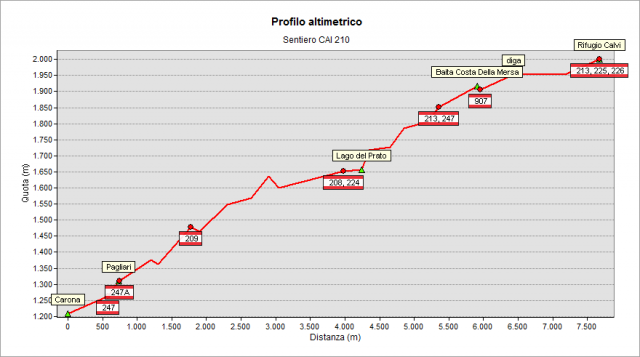
It starts from the bend (1222 m - easy parking) located along the road that runs above the village (turn left immediately after the cemetery and climb for about 1.5 km) and then rise almost entirely along the ENEL service road, mostly unpaved. The pretty sloping road - after a while - comes to a hamlet (Pagliari, 1314 m) and continues, passing near the Sambuzza valley waterfall and Dosso place. After it, the trail becomes less steep and continues up to the lake “del Prato” (1654 m). The trail continue up to Costa della Mersa hut and up to the Fregabolgia lake. Climb the stairs leading to the top of the dam and finally - with almost flat path and along the lake – you reach the Calvi Hut (2006 m). Note: along the route you meet other useful paths: in the nice hamlet of Pagliari (1315 m) you can see on your right the path n° 247 (the so-called "summer trail", a recommended alternative!) and you meet path n° 208 (coming from Foppolo to Calvi Hut) when you reach the lake “del Prato”.
To see all the way through Google Street View Trekker: click here
Topografia