Descrizione
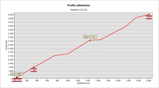
Reach the so-called “Il Pozzo” ENEL (1800 m, an odd hydraulic build) along path n° 331 that climbs from Valbondione. Climb in the valley along the fall line and - at 2100 m - turn left (west) reaching, always in steep terrain, the plain that is home to “d’Avert” lake (2310 m). After crossing the lake, begins to rise again through the path traces on rough grazing. It continues first on rocks and then screes (beware of marks!), in the wild until crossing the path n° 302 (2600 m about, Central-Eastern Orobie Trail / Sentiero delle Orobie, the so-called “higher variant”) leading - by a short uphill - to "Ol Simàl" (2712 m) the highest point of the Central-Eastern Orobie Trail / Sentiero delle Orobie.
Topografia
Profilo altimetrico
Sentieri collegati
Documentazione
Cartografia
Carta Escursionistica della Provincia di Bergamo
Tavola 02
Tavola 03