Descrizione
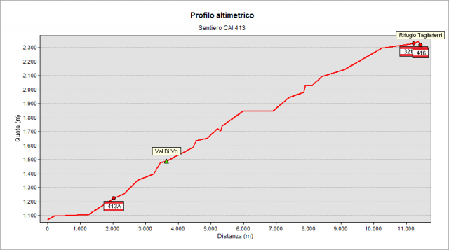
From Ronco hamlet of Schilpario village (1075 m) take the mule track following upstream Vo valley. Near the waterfalls (deviation on the right) the trail climbs up in the woods along the left side of the valley (right orographic). At height 1650 m (Venano di Mezzo) cross the creek (on a wooden bridge) and climb steeply to the Venano di Sopra basin (1850 m). Walk around it to take again a mule track with constant slope and wide hairpin bends up to height 2202 m. Turn northward and, on path with gentle slope, get easily Rifugio Nani Tagliaferri (2328 m).
Per vedere tutto il percorso con Google Street View Trekker clicca qui
Topografia
Sentieri collegati
Documentazione
Note
E' possibile anche partire da Paghera (1102 m) e seguire il sentiero 414 per un breve tratto, poi tenere la sinistra verso le cascate del Vo e ricollegarsi al sentiero 413.