Descrizione
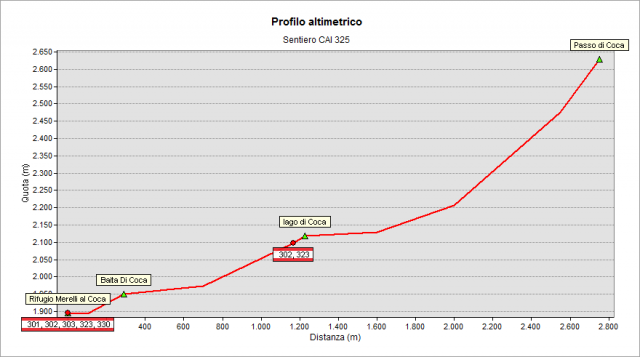
The path starts from the Coca Refuge (1892 m). In the first part, the track is shared with the path n° 302 and you rise the valley until you reach the lake of Coca (2108 m). The trail runs along the lake, passing it and begins to rise with increasing slope – by tracks - along the big scree descending from Coca Pass (2645 m).
Topografia
Profilo altimetrico
Sentieri collegati
Documentazione
Cartografia
Carta Escursionistica della Provincia di Bergamo
Tavola 02
Tavola 03